Marwaa Hanee Mohsen*![]() | Fadhil M. Al-Mohammed
| Fadhil M. Al-Mohammed![]()
© 2023 IIETA. This article is published by IIETA and is licensed under the CC BY 4.0 license (http://creativecommons.org/licenses/by/4.0/).
OPEN ACCESS
Water quality was assessed for the main Hilla canal and three distributary channels (HC 19 at 49+243 km, HC 20 at 52+123 km, and HC 2L at 44+056 km), located in the alraarinjia of Babil, for the Hilla-Kifil Irrigation Project. The Canadian Water Quality Index (CWQI) is used to assess the irrigation water quality of the Hilla Main Canal and three distributary channels. Water samples were collected monthly from February to May 2021 and analyzed for electrical conductivity, pH, sodium adsorption ratio, total hardness, magnesium, sodium, and calcium, and compare with specifications. Based on the current outcomes, it was found that all the elements fall within the specifications until some tests where they were outside the specification, as in (TH). Besides, the value of CWQI (94.73%) was between good and excellent, and this indicates that the water is appropriate for irrigation purposes in that area. The findings of the current studies, in comparison with previous studies on the one hand and the standard specifications on the other, proved the effectiveness of the indicator and the accuracy of its results. This means, The Hilla Main Canal and distributary channels generally have good irrigation water quality according to the CWQI, But the slight increase in total hardness requires monitoring and treatment.
water quality index, irrigation water, Hilla Main Canal, water hardness, Iraq
Assessment of existing water quality is the first step in the use of waterbodies; the next step is the determination of the specific use based on the result of the water quality assessment. In addition to this, the particular use of each body of water should be the highest possible use, and it should also take into consideration the social demand for its current or desired usage [1].
The conventional method for evaluating water quality compares the detected value of a variable in a water sample to a desirable limit for that variable. To assess the integrity of the water, numerous variables must be determined. However, at the present time, it has been relying on water quality indices (WQIs) have been extensively implemented. The higher the number on the scale, the better the water quality, and the lower the number, the worse the water quality [2].
Horton developed the first water quality index based on 10 criteria in 1965, and since then the topic has witnessed great interest from researchers, and the attractions have varied in multiple directions for the purpose of developing this index. Lumb et al. [3] reported that one of the most efficient and simple procedures for WQI calculations is the Canadian WQI procedure (CWQI). The study also discussed and identified the most commonly used parameters. In their study, Al-Mohammed et al. [4] utilized the CWQI index and came to the conclusion that in order to confirm good irrigation management, it is necessary to monitor future changes in groundwater in the study area, as well the characteristics that affect water quality.
According to Sarkar and Islam [5], the water supply and its chemical composition have an impact on the characteristics and quantity of these dissolved salts. Also, they confirmed that the quantity and concentration of these ions, which are the most frequently dissolved in water, are used to assess whether or not the water is suitable for irrigation. At various positions along the Euphrates River, Al-Rekabi and Al-khafaji [6] applied the CCME WQI for use as irrigation. Their findings revealed that the Euphrates River's irrigation water quality index value ranged from 67.93 to 47.66, indicating that the river was used for irrigation to a considerable extent. In same way, Al-Obaidy et al. [7] used the (WQI) developed for the Canadian system to determine the Tigris River's water quality. Within the city of Baghdad, samples of water were taken from the river's upstream, midstream, and downstream sections respectively. Eleven parameters were employed, and the results demonstrate that the Tigris River in Baghdad city is very contaminated for the aquatic life. This is evidenced by the fact that all of the stations in both the winter and summer seasons had low valuations. In a similar manner, and by utilising the CCME WQI index, Bilgin [8] uncovered that the water in the Coruh River Basin (Turkey) is not close to either natural or intended standards. In order to get at these findings, they investigated and examined a number of different parameters. On the other hand, Kükrer and Mutlu [9] reached different results, as their results indicated that the water category of the Saraydüzü Dam Lake is a very good category. They discussed and measured many variables to determine the water quality, reaching 28 monthly variables and six stations. They also confirmed that the lake's ecosystem is valid, as there are no heavy metals that could harm the lake's ecosystem.
Based on the above survey, it is noted that the uses of this indicator are many, and the benefits of using it are also many. In addition to the different variables used by researchers and the different results. The objective of this current study to assess the irrigation water quality of the Hilla Main Canal and three distributary channels using the Canadian Water Quality Index (CWQI).
The current investigation covers a portion of the Hilla-Kifil irrigation project in Iraq. This section focuses on the Hilla main canal as well as the beginnings of three distributary canals: (HC 19) at 49+243 km, (HC 20) at 52+123 km, and (HC 2L) at 44+056 km. The Hilla-Kifil project region is located at an eastern longitude of 44°13' to 44°26' and a northern latitude of 32°13' to 32°43'. The major canal in Hilla has some lining. The project area spans approximately 50 kilometres from north to south and 20 kilometres from west to east. The climate of the study area is characterized by a high temperature during the months from April to October and begins to decrease in November to reach values close to zero in January.
The soils in the project area were formed from parent material of alluvial deposits of the river Euphrates and of recent irrigation deposits. Three major groups have been found for soil: course to medium textured, high lying soils with favorable hydrological conditions (levee soils), medium to fine textured, lower lying soils with slightly higher groundwater table (basin soils) and fine textured soils, low lying soils with unfavorable hydrological conditions (depression soils). Figure 1 displays the target area in the current study.
Figure 1. Area under consideration
3.1 Samples of study
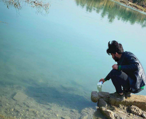
In this study, five samples were chemically analyzed, two of which were taken from the main Hilla canal and three from three distribution channels at head (HC 19, HC 20, and HC 2L) for a period of four months (from February 2021 until May 2021), as presented in Figure 1. The samples were taken from the site at a depth of 20 cm below the water level from five points as shown in Figure 2, different locations and according to the required specification. After that, the samples are delivered to the laboratory and kept at room temperature. The nature of the waters of the main Hilla canal and three distribution channels entered in this study is of the same nature as the waters of the Euphrates River, as there is no source of water pollution. A chemical analysis was performed on these samples for various elements, including: pH, Electrical Conductivity (EC), Total Dissolved Solids (TDS), Chloride (Cl-1), Sodium (Na+), Potassium (K+), Calcium (Ca+2), Magnesium (Mg+2), Sulphate (SO4-2), Total Hardness (TH), and Sodium Adsorption Ratio (SAR). Sodium Adsorption Ratio (SAR) entered in the calculation of irrigation water quality index (IWQI or CWQI) and Sodium Content Percentage (Na%) were also calculated to be compared with standard limitations [10].
(a) Take the sample from the specified point
(b) Arranging samples for examinations
Figure 2. Samples taken from specified points
3.2 Parameters of study
Quality of irrigation water is defined by using several parameters:
3.2.1 Salinity hazard
The comprehensive evaluation of water quality involves the assessment of soluble salts, sodium's relative proportion to the proportions of the other cations, bicarbonate concentrations, and the concentrations of particular elements and compounds. This information is used to estimate the risk of salinity. The first form of salt problem is linked with overall salinity, and the second type of salt problem is associated with sodium. Both of these salt problems are distinct from one another. Either one or both of these factors can have an effect on soil [11]. Total dissolved solids, or TDS, can also be measured or stated in parts per million (ppm) or its equivalent, milligrams per litre (mg/l). EC, which stands for electric current, is actually a measurement that can be stated in three different units.
Total dissolved solids, also known as TDS, are equal to the concentration of all ions that are present in the water and represent the total amount of solids that have been dissolved in the water. TDS is measured in milligrams per liter (mg/l), which is the unit of measurement [12]. We categorized the irrigation water according to the TDS values [13]. This is a function of the ionic power of water, which is determined by the quantity of cations and anions that are present in the water. Electrical conductivity, or EC, is a measure of the ionic strength of a solution for the purpose of conveying electrical current. Electrical conductivity can be expressed in micro Siemens units per centimeter or in micro Mhos units per centimeter [12], and irrigation water can be categorized according to EC values.
3.2.2 Sodium hazard
Two measures for expressing the sodium hazard are the soluble sodium percentage (SSP) and sodium absorption ratio (SAR) [14]. When determining sodium concentration for SSP, the unit of meq/l (mile equivalents per litre) is added to the total of cations and multiplied by 100. When the SSP contains more than 60% water, sodium accumulates, which causes the physical qualities of the soil to collapse [15]. The amount of sodium in irrigation waters is also reported as a percentage of soluble sodium (SSP), which may be calculated using the equation below and categorized based on SSP values as shown in Table 1 [15].
$S S P=\frac{(N a+K)}{(N a+K+C a+M g)} \times 100 \%$ (1)
Moving on to SAR, Excessive salts in some soils and high quantities of exchangeable sodium in others have a negative impact on plants both physically and chemically. Poor tilt and low permeability are frequent characteristics of exchangeable sodium-rich soils, making them unfavorable for plant growth. The SAR is a measure of the ratio of sodium ions to calcium and magnesium ions in a water sample. It is used to forecast the salt risk in a sample of irrigation water. When using sodic water continuously, it is also utilized to forecast the possibility of sodium accumulating in the soil [16]. Also, Table 1 displays the classification of irrigation water based on SAR values.
Table 1. SSP-based classification of irrigation water and water's sodium hazard based on SAR values
|
SSP (Na%) |
Water Class |
SAR values |
Sodium hazard of water |
Comments |
|
<20 |
Excellent |
1-10 |
Low |
Use on crops sensitive to salt, like avocados, should be avoided. |
|
20–40 |
Good |
10-18 |
Medium |
Leaching and amendments (like gypsum) are required. |
|
40–60 |
Permissible |
18-26 |
High |
In general, it is unfit for ongoing use. |
|
60–80 |
Doubtful |
>26 |
Very High |
Generally unsuitable for use |
|
>80 |
Unsuitable |
|
|
|
3.2.3 Total hardness (TH)
A practical test to assess the quality of water for home, agricultural, and industrial usage is the assessment of water hardness. Water hardness is typically brought on by calcium and magnesium. Permanent and transitory hardness are the two categories into which the total hardness of water can be divided. According to TH, water is divided into four groups and expressed by its equivalent in calcium carbonate, as indicated in Table 2:
$T H=2.5 \mathrm{Ca}^{+2}+4.1 \mathrm{Mg}^{+2}$ (2)
Table 2. Total hardness classifications of water
|
Total Hardness (ppm) |
Water class |
|
0-75 |
Soft |
|
75-150 |
Moderately hard |
|
150-300 |
Hard |
|
>300 |
Very hard |
3.2.4 Chloride hazard and effect PH
In irrigation water, chloride ions are typical. Low concentrations of chloride are necessary for the cultivation of the plant, but high concentrations of chloride can be toxic to sensitive plants. If the crop's tolerance for the chloride contamination in the leaves is exceeded, injury symptoms like leaf burn or drying of the leaf tissue appear. These signs appear when chloride builds up in the paper at levels between 0.3 and 1%, is not absorbed by the soil, but instead easily travels with the soil water [17]. Additionally, the pH of irrigation water should be between 6.5 and 8.4. In irrigation water, pH levels that are higher than normal can lead to nutritional imbalances or toxic ions. Where irrigation system corrosion already exists, low pH may accelerate it. For irrigation water, a usual pH range is between 6.5 and 8.4 [18].
4.1 Chemical analysis
The results of chemical analysis of 11 variables (pH, electrical conductivity (EC), total dissolved solids (TDS), chloride (Cl-1), sodium (Na+), potassium (K+), calcium (Ca+2), magnesium (Mg+2), sulphate (SO4-2), total hardness (TH), and sodium absorption ratio (SAR)) and the number of 240 tests for all points are shown in Table 3. The average values of five locations for four months are shown in Table 4, while group of water quality based on CWQI shown in Table 5. Table 4 is compared with the specifications mentioned in Table 6.
Accordingly, the pH ranged from 7.1 in February at site 4 to 8.2 in May at site 2, as shown in Table 3. Besides, the average values ranged from 7.38 to 8.06 based on Table 4. In general, it can be considered that concentrations were within specification limits at all sites during the four months.
Table 3. Results of chemical analysis of water for two points on Hilla main canal and three points at head of (HC 19, HC 20 and HC 2L)
|
Location |
Type Month |
PH |
E.C µS/cm |
TDS ppm |
Cl- ppm |
Na+ ppm |
K+ ppm |
Ca+2 ppm |
Mg+2 ppm |
So4-2 ppm |
T.H ppm |
SAR |
Na % |
|
1 (HC 19) |
Feb. |
7.5 |
915 |
548 |
81 |
69 |
3.2 |
62 |
32 |
209 |
286 |
10.1 |
43.4 |
|
Mar. |
7.7 |
922 |
550 |
84 |
74 |
3.5 |
66 |
36 |
211 |
313 |
10.4 |
43.2 |
|
|
Apr. |
7.9 |
948 |
575 |
82 |
79 |
4.3 |
87 |
42 |
238 |
390 |
9.8 |
39.2 |
|
|
May |
8.1 |
960 |
583 |
88 |
82 |
5.0 |
124 |
47 |
243 |
503 |
8.9 |
33.7 |
|
|
3 (HC 20) 2 |
Feb. |
7.2 |
925 |
552 |
79 |
70 |
3.5 |
61 |
31 |
217 |
280 |
10.3 |
44.4 |
|
Mar. |
7.4 |
945 |
561 |
83 |
73 |
3.8 |
65 |
33 |
220 |
298 |
10.4 |
43.9 |
|
|
Apr. |
7.8 |
953 |
576 |
86 |
77 |
4.1 |
82 |
39 |
235 |
365 |
9.9 |
40.1 |
|
|
May |
8.2 |
965 |
580 |
87 |
78 |
4.8 |
125 |
43 |
240 |
489 |
8.5 |
33.01 |
|
|
Feb. |
7.6 |
924 |
542 |
85 |
68 |
3.4 |
63 |
35 |
210 |
301 |
9.7 |
42.1 |
|
|
Mar. |
7.65 |
939 |
550 |
93 |
76 |
3.6 |
67 |
40 |
213 |
332 |
10.4 |
42.7 |
|
|
Apr. |
7.9 |
957 |
569 |
90 |
79 |
3.9 |
89 |
43 |
234 |
399 |
9.7 |
38.6 |
|
|
May |
8.0 |
966 |
584 |
88 |
81 |
4.0 |
120 |
46 |
244 |
489 |
8.9 |
33.9 |
|
|
4 (HC 2L) 5 |
Feb. |
7.1 |
919 |
549 |
80 |
73 |
3.6 |
59 |
37 |
215 |
299 |
8.98 |
44.4 |
|
Mar. |
7.3 |
936 |
563 |
82 |
77 |
3.7 |
63 |
41 |
219 |
326 |
10.7 |
43.7 |
|
|
Apr. |
7.7 |
955 |
573 |
83 |
81 |
4.2 |
84 |
42 |
236 |
382 |
10.2 |
40.3 |
|
|
May |
7.9 |
968 |
581 |
86 |
84 |
4.9 |
122 |
45 |
242 |
490 |
9.2 |
34.7 |
|
|
Feb. |
7.5 |
942 |
565 |
90 |
70 |
3.2 |
64 |
30 |
222 |
283 |
10.2 |
43.8 |
|
|
Mar. |
7.6 |
954 |
574 |
92 |
75 |
3.6 |
69 |
34 |
224 |
312 |
10.5 |
43.3 |
|
|
Apr. |
7.8 |
958 |
582 |
91 |
80 |
3.8 |
92 |
44 |
240 |
410 |
9.7 |
38.1 |
|
|
May |
8.1 |
963 |
587 |
89 |
83 |
3.9 |
126 |
46 |
245 |
512 |
8.95 |
33.6 |
Table 4. Average values of five locations of the tested elements during four months
|
Month |
pH |
EC µS/cm |
TDS ppm |
Cl- ppm |
Na+ ppm |
K+ ppm |
Ca+2 ppm |
Mg+2 ppm |
So4-2 ppm |
TH ppm |
SAR |
Na% |
|
Feb. |
7.38 |
925 |
551 |
83 |
70 |
3.4 |
62 |
33 |
215 |
290 |
9.9 |
43.6 |
|
Mar. |
7.53 |
939 |
560 |
87 |
75 |
3.6 |
66 |
37 |
217 |
316 |
10.5 |
43.4 |
|
Apr. |
7.82 |
954 |
575 |
86 |
79 |
4.1 |
87 |
42 |
237 |
389 |
9.9 |
39.3 |
|
May |
8.06 |
964 |
583 |
88 |
82 |
4.5 |
123 |
45 |
243 |
497 |
8.9 |
33.8 |
|
Limits (FAO,1994) |
6-8.5 |
≤3000 |
≤2000 |
≤1065 |
≤920 |
≤78 |
≤400 |
≤150 |
≤960 |
≤500 |
≤15 |
- |
EC values varied from 915-968 µS/cm, where the mean minimum value was 925 µS/cm in February and the highest mean value was 964 µS/cm in May. It is clear that EC varies on the type and concentration of ions in the water, and these values are related to chloride concentrations (Cl), whose average values range from 83 to 88 ppm as in Tables 3 and 4 and increase with increasing temperature as well.
This indicates a growth in the EC values of the main channel and the distributed channels due to the rise in temperatures towards the summer season, as the concentrations increase and the levels of water in the channels decrease. In general, when compared with Table 6, all sites are within the limits due to the absence of a salt source affecting the water.
The TDS concentration ranged between 542 and 587 ppm, and the minimum average value was 551ppm in February, while the highest average value was 583 ppm in May (Tables 3 and 4). Accordingly, the values of TDS and EC are associated with the rate of water releases for each month, according to the system that is followed by the project management of the study area. This water is considered fresh according to the standard specifications, as all values were less than 3000, and it is also considered within the limits in Table 7.
Total hardness (TH) concentrations during this study ranged from 280 ppm in site 2 during February to 512 ppm in site 5 during May. Also, the upper limit of the average values is 497 in the same month (Tables 3 and 4). On the whole, all concentrations of TH in the waters are within the specifications (less than 500) in Table 7, except for the values in locations 1 and 5 during the month of May that were more than 500. In comparison with Table 3, some tests were within the limit (150-300) and therefore classified as difficult, but some of them were more than 300 and were considered very difficult, meaning they are of high difficulty.
The reason is due to the slight increase in calcium and magnesium ions in this month compared to the previous months, although the values of these ions and their rates in Table 3 and Table 4 are within the limits of the specifications.
The irrigation channels that are opened for one month are divided, so the water level decreases and the ions increase in the month of May due to the lack of water imports from the Euphrates River. However, it is considered good for irrigation and agricultural purposes and achieves the goal of the study.
By going to the concentrations of each of potassium (K+) and sulphate (SO4-2) in Table 3 and the average values in Table 4 for all locations and months, it can be said that they were within the limits of the specifications in Table 7, and this reason is due to the absence of a source of heavy water and others.
As for the concentrations of sodium (Na+), whose value ranges between 68 and 84 ppm, the average values change between 70 and 82 in Table 3 and Table 4, and in general, when compared in all locations, they were found to be within the limits. As for Na%, all tests fall within the specification limit (20-60) when compared with Table 1, where they are classified between good and permissible.
Also, the sodium absorption rate (SAR) ranged between 8.5 and 10.7, while the average ranged between 8.9 and 10.5, as shown in Table 3 and Table 4. Generally, when compared with Table 7 in all locations, it was found to be less than 15. As for the specification in Table 1, which was used by previous researchers, some tests were less than 10 and therefore classified as low water risks (you should be careful not to use them on sodium-sensitive crops such as avocado), and some of them were more than 10. It is considered a medium-risk area for water, and therefore the soil needs to be washed when used in some months.
4.2 Water quality index (CWQI)
IWQI was developed to measure the overall impact of the hazard groups, including salinity, permeability, basic ion and trace element toxicity, and the various effects on irrigation water quality. This index consists of three variables, each of which has a scale from 0 to 100. A vector is produced in an imagined "objective exceedance" space using the values of the three measures of variance from chosen water quality objectives. As indicated in Table 6, the vector's length is then scaled to fall between 0 and 100 and subtracted from that value to give an index that, for extremely poor water quality, is close to 0 and, for great water quality, is close to 100. Table 3 provides laboratory values and calculations required to apply the recommendations. The following three CWQI factors were used in the current study:
The following equation is used to calculate Factor 1 (F1 (scope)), which represents the proportion of variables to the total number of measured variables that do not reach their objectives:
$F_1=\left(\frac{\text { number of } \text { failed variables }}{\text { total number of variables }}\;\;\;\right) \times 100 \%$ (3)
While Factor 2 (F2 (Frequency)), which expresses the proportion of individual tests that do not meet the objectives (failed tests), is calculated using Eq. (4) to determine how many of the tested or observed values do not meet the objective limits,
$F_2=\left(\frac{\text { number } \text {of} \text { failed tests }}{\text { total number of tests }}\;\;\right) \times 100 \%$ (4)
Factor 3 (F3 (Amplitude)) is the final factor and is calculated in three phases. It shows the degree to which the objectives of the failed test values are not satisfied (amplitude). The term "excursion" is used to describe the frequency with which an individual's concentration exceeds the objective (or falls short of the aim when it falls below the minimum):
excursioni $^{=}\left(\frac{\text { falied test } \text {value}_\;\;i}{\text { objective}_\;\;j}\;\right)-1$ (5)
excursioni $^{=}\left(\frac{\text {objective}_\;\;j}{\text { falied test value}_\;\;\;\;i}\;\right)-1$ (6)
It is important to note that Eq. (5) should be used when the value of the test must not be greater than the objective, and Eq. (6) should be used when the value of the test must not be less than the target. Both of these situations are discussed further below. After computing the total sum of the individual tests' deviations from the objectives of those tests, one then divides the total number of tests by the sum to obtain the overall amount by which the individual tests are not in conformity with the standard. The normalised sum of excursions (nse), a variable, is considered as follows:
nse $=\frac{\sum_{i=1}^n \text { excursion }_\;\;i}{\text { number } \text {of} \text { test }}$ (7)
Then, F3:
$F_3=\frac{n s e}{0.01 \ n s e+0.01}$ (8)
Then,
$C W Q I=W Q I=100-\frac{\sqrt{F_1{ }^2+F_2{ }^2+F_3{ }^2}}{1.732}$ (9)
Depending on the laboratory output values of the elements in the Table 3 and using the above equations, the value of the indicator was calculated as shown in the Table 7, where the number of failed variables was (1) in relation to the total number (11) to calculate the factor (F1=9.09). The number of failed checks (2) in relation to the total number (240) to calculate the factor (F2=0.83), as for the value of the deviations of the checks as indicated in the Table 3 from the specification of the Total hardness (TH) was (e1= 0.006 and e2=0.024), as for the value of the sum for them (1.25*10-4) that is to calculate the value of (F3=0.0125). Through the three values (F1, F2 and F3), Found the Canadian Water Quality Index equal to (94.73), and compared to the specification in the Table 5, where the value is classified between good to excellent. This indicates the water quality for the current study area for irrigation purposes.
It can be established based on the current outcomes that the water samples indicate that all concentrations are within the acceptable and good limits; although they increased slightly in some months, this does not prevent their use for irrigation purposes. The reason is due to the nature of area under consideration, which is characterized by the absence of factories and heavy water streams. Also, the months in which the samples were taken are characterized by a moderate temperature, except that it increased slightly in May compared to the rest of the months in Iraq. In comparison with Karim et al. [19], where the Shatt al-Arab region was used, opposite the current study area, it was found that the concentrations increased due to the presence of the salt source close to it and the nature of the polluted area. Al-Obaidy et al. [7] also does not agree with our current study, as the concentrations increased due to the presence of polluting sources. This necessitates the existence of studies to conserve water for water channels due to its impact on agricultural lands and crops. Furthermore, it was found that all the elements fall within the specifications, as shown in Table 4 which was compared with the specifications mentioned in Table 6, and it was found that all elements fall within the limits except (TH) in the month of May due to the increase in calcium, magnesium, and sulphate ions in this month compared to the previous months, as shown in Table 3.
In general, Table 3 shows the results of the application of this method to the data of the Hilla main canal and three distributary canals (HC 19, HC 20, and HC 2L) for five locations. Accordingly, the Canadian Water Quality Index (CWQI) is 94.73%, which indicates that the quality of water in the Hilla main canal and three distributary canals that are used for irrigation, according to Table 5, is classified as good to excellent.
Table 5. Group of water quality based on CWQI
|
Class |
Water Quality Index Value |
Water Quality |
|
I |
100-95 |
Excellent |
|
II |
94-80 |
Good |
|
III |
79-60 |
Fair |
|
IV |
59-45 |
Marginal |
|
V |
44-0 |
Poor |
Table 6. Laboratory tests are required to assess common irrigation water quality issues
|
Water Parameter |
Symbol |
Unit |
Usual Range in Irrigation Water |
Atomic Weight |
|
Salinity |
||||
|
Salt Content |
||||
|
Electrical Conductivity (or) Total Dissolved Solids |
ECw
TDS |
µS/cm
ppm |
0-3000
0-2000 |
-
- |
|
Cations |
||||
|
Calcium |
Ca+2 |
ppm |
0-400 |
40.1 |
|
Magnesium |
Mg+2 |
ppm |
0-150 |
24.3 |
|
Sodium |
Na+ |
ppm |
0-920 |
23 |
|
Potassium |
K+ |
ppm |
0-78 |
39.1 |
|
Anions |
|
|
|
|
|
Chloride |
$\mathrm{Cl}^{-}$ |
ppm |
0-1065 |
35.5 |
|
Sulphate |
SO4-2 |
ppm |
0-960 |
96.1 |
|
Miscellaneous |
|
|||
|
Acid/Basicity |
pH |
- |
6.0-8.5 |
- |
|
Sodium Adsorption Ratio |
SAR |
- |
0-15 |
- |
|
Total Hardnes |
TH |
ppm |
0-500 |
- |
|
Sodium Content |
SSP |
- |
- |
- |
Table 7. Calculation of CWQI by CCME for Hilla main canal and three distributary canals
|
The Factors of CWQI |
Equation Results |
|
F1$=\left(\frac{\text { number of failed variables }}{\text { total number } \text {of} \text { variables }}\;\;\;\;\right) * 100=\frac{1}{11} * 100$ |
9.09 |
|
F2$=\left(\frac{\text { number } \text {of} \text { failed tests }}{\text { total number} \text { of tests }}\;\;\;\right) * 100=\frac{2}{240} * 100$ |
0.83 |
|
excursioni $=\left(\frac{\text { falied test } \text {value}_\;\;{\mathrm{i}}}{\text { objective}_\;\;{\mathrm{j}}}\;\;\right)-1$ $\mathrm{e} 1=\left(\frac{503}{500}\right)-1$ $e 2=\left(\frac{512}{500}\right)-1$ |
e1= 0.006 |
|
e2= 0.024 |
|
|
nse $=\frac{\sum_{i=1}^n \text { excursion}_\;\;i}{\text { number } \text {of} \text { test }}=\frac{(0.006+0.024)}{240}$ |
1.25*10-4 |
|
F3=$\frac{n s e}{0.01 \ n s e+0.01}=\frac{1.25 * 10^{-4}}{0.01 * 1.25 * 10^{-4}+0.01}$ |
0.0125 |
|
CWQI=$100-\frac{\sqrt{F_1{ }^2+F_2{ }^2+F_3{ }^2}}{1.732}$ |
94.73 |
1. During the chemical analysis of the elements in the four months, most of the elements, which include (EC, TDS, PH, Cl-, K+, So4-2, Na+) were within the specifications and are considered good for irrigation and agriculture purposes except for some total hardness tests (TH) that were slightly higher than the specifications in the month of (May) as a result of the slight increase in the value of the elements (Calcium and magnesium) although they are within the specifications, and also the elements (SAR) increase very slightly in the same month, but remain within the limits of the specifications. The reason is due to the decrease in the water level from the source in the month of May, according to the system followed by the project management, and it increases in other months.
2. Depending on the test values of the parameters in the first paragraph, the value of the Canadian Water Quality Index was calculated, and when comparing the obtained value, we found that the value of the indicator (WQI) is within the specifications, and accordingly we conclude that the Hilla-Kilif project is suitable for irrigation and agricultural purposes for all crops. This indicates that there is no brine source or factories and heavy watercourses.
3. The main factors affecting the water quality in the canals is the low levels of the rivers. Therefore, the quantities of water should be preserved during the winter by the project management supervising the study area to be used in the summer. Also, the use of samples for more examinations for more months to see the change that occurs due to the high temperatures in Iraq.
[1] Mukherjee, A., Sen, S., Paul, S.K. (2017). A deviation from standard quality approach for characterisation of surface water quality. International Journal of Sustainable Development and Planning, 12(1): 30-41. http://doi.org/10.2495/SDP-V12-N1-30-41
[2] Ismail, A.H., Robescu, D., Hameed, M.A. (2018). Application of CCME WQI in the assessment of the water quality of Danube River, Romania. Engineering and Technology Journal, 36(2 Part C): 142-146. https://doi.org/10.30684/etj.36.2C.8
[3] Lumb, A., Sharma, T.C., Bibeault, J.F. (2011). A review of genesis and evolution of water quality index (WQI) and some future directions. Water Quality, Exposure and Health, 3: 11-24. https://doi.org/10.1007/s12403-011-0040-0
[4] Al-Mohammed, F.M., Al-Saadi, R.J.M., Al-Fawzy, A.M., Mohammed-Ali, S.H., Mutasher, A.A., Hommadi, A.H. (2021). The analysis of water quality using canadian water quality index: Green belt project/kerbala-Iraq. Journal Homepage: http://iieta. org/journals/ijdne, 16(1): 91-98. https://doi.org/10.18280/ijdne.160112
[5] Sarkar, B., Islam, A. (2019). Assessing the suitability of water for irrigation using major physical parameters and ion chemistry: A study of the Churni River, India. Arabian Journal of Geosciences, 12: 1-16. https://doi.org/10.1007/s12517-019-4827-9
[6] Al-Rekabi, H.Y., Al-khafaji, B.Y. (2014). Applied of CCME water quality index for evaluation of water quality of Euphrates River for irrigation purposes in Al-Nassiryia city. Journal of Thi-Qar Science, 4(3).
[7] Al-Obaidy, A.H.M.J., Al-Janabi, Z.Z., Shakir, E. (2015). Assessment of water quality of Tigris River within Baghdad City. Mesopotamia Environmental Journal, 1(3): 90-98.
[8] Bilgin, A. (2018). Evaluation of surface water quality by using canadian council of ministers of the environment water quality index (CCME WQI) method and discriminant analysis method: A case study Coruh River Basin. Environmental Monitoring and Assessment, 190: 1-11. https://doi.org/10.1007/s10661-018-6927-5
[9] Kükrer, S., Mutlu, E. (2019). Assessment of surface water quality using water quality index and multivariate statistical analyses in Saraydüzü Dam Lake, Turkey. Environmental Monitoring and Assessment, 191: 1-16. https://doi.org/10.1007/s10661-019-7197-6
[10] Carranzo, I.V. (2012). Standard methods for examination of water and wastewater. In Anales de Hidrología Médica. Universidad Complutense de Madrid, 5(2): 185.
[11] Zaman M., Shahid, S.A., Heng, L., Zaman, M., Shahid, S.A., Heng, L. (2018). Irrigation water quality. Guideline for Salinity Assessment, Mitigation and Adaptation Using Nuclear and Related Techniques, 113-131. https://doi.org/10.1007/978-3-319-96190-3_5
[12] Khether, S.I., Khalaf, H.H., Hassan, I.T. (2019). Measuring total dissolved solids (TDS) and electrical conductivity (EC) in domestic wells water in some regions of mosul city. College of Basic Education Researches Journal, 15(3).
[13] Incrocci, L., Thompson, R.B., Fernandez-Fernandez, M.D., De Pascale, S., Pardossi, A., Stanghellini, C., Rouphael, Y., Gallardo, M. (2020). Irrigation management of european greenhouse vegetable crops. Agricultural Water Management, 242: 106393. https://doi.org/10.1016/j.agwat.2020.106393
[14] Maia, C.E., Rodrigues, K.K.R.D.P. (2012). Proposal for an index to classify irrigation water quality: A case study in northeastern Brazil. Revista Brasileira de Ciência do Solo, 36: 823-830. https://doi.org/10.1590/S0100-06832012000300013
[15] Alsubih, M., Mallick, J., Islam, A.R.M.T., Almesfer, M.K., Kahla, N.B., Talukdar, S., Ahmed, M. (2022). Assessing surface water quality for irrigation purposes in some dams of asir region, saudi arabia using multi-statistical modeling approaches. Water, 14(9): 1439. https://doi.org/10.3390/w14091439
[16] Fadeyibi, A., Halilu, A. (2011). Salinity effects of irrigation water on maize crop production at Maizube Farms, Minna, Nigeria. Journal of Biodiversity and Environmental Sciences (JBES), 1(6): 63-68.
[17] Hamza, N.H. (2012). Evaluation of water quality of Diyala River for irrigation purposes. Diyala Journal of Engineering Sciences, 5(2): 82-98.
[18] Akter, T., Islam, M.K., Islam, M.M.S., Monirul, M. (2019). Irrigation water quality assessment of Betagi Upazila under barguna district in Bangladesh. Archives of Agriculture and Environmental Science, 4(4): 428-433. https://doi.org/10.26832/24566632.2019.040409
[19] Karim, H.H., Ziboon, A.R.T., Al-Hemidawi, L.M. (2016). Assessment of water quality indices for Shatt Al-Basrah River in Basrah City, Iraq. Eng. &Tech. Journal A, 34: 7039-7057. https://doi.org/10.30684/etj.34.9A.8